GIS For Emergency Services
GIS Is More Than A Command And Control System, It's Used For Protection And Preventative Measures
The use of GIS within emergency services is central to the management and coordination of relief services. Advances in technology have firmly positioned GIS as more than a command and control system, it used for protection and preventative measures.
GIS provides emergency services with the tools to not only coordinate response teams but also to support daily operational management reporting via the analysis of incident reports, GPS tracking of vehicles, asset management, emergency planning, route optimisation and remote data capture.
By using Azimap, emergency services can seamlessly integrate GIS within existing reporting and data capture processes using the API, allowing for the introduction of mapping capabilities to existing processes.
Due to the sensitive nature of the information being collected, emergency services can avail of a self-hosted or cloud installation. Administrators can assign teams and roles for various users using Active Directory where available.
Discover how Azimap can be used for protection and preventative measures within emergency services by requesting a personalised demonstration or by signing up to a free trial.
Interactive Case Studies

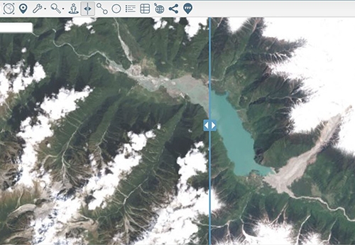
Layer Swipe Map of Zhamu Creek Landslide
One of the world's largest recorded landslides occurred at Zhamu Creek in Eastern Tibet.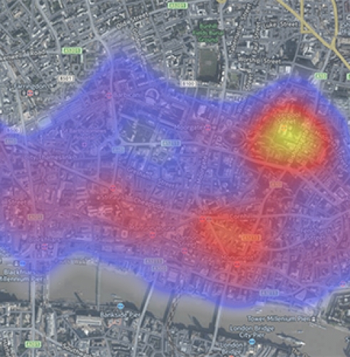
2016 City of London Crime Heat Map
Heatmap, highlighting the reported crimes in the City of London in June 2016.