GIS For Environmental Services
Using GIS To Evaluate Species, Noise Pollution And Other Environmental Issues
The use of GIS, has become an essential tool of modern environmental science. Using Azimap web GIS, government agencies and private organisations can work collaboratively with all stakeholders to critically evaluate species, nose pollution and many other environmental issues.
Azimap, provides GIS managers and teams with the tools to work collaboratively to provide more accurate reporting and support smart decision making. Using the map styling tools, professionals can present data as a heat, thematic and or point map. Professionals can also use the advanced spatial analysis tools to help identify new relationships and insights in their data.
As citizens are becoming more environmentally aware, local government and private organisations have become more proactive in the sharing of spatial information. Using Azimap, local government and organisations can disseminate maps and information across the internet using Azimap's map publishing and sharing tools.
Discover how Azimap can be used to evaluate species, noise pollution and other environmental issues by requesting a personalised demonstration or by signing up to a free trial.
Interactive Case Studies

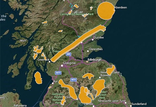
Species Conservation and Grey Squirrel Control Areas in Scotland
Locate the grey squirrel control and species conservation areas within Scotland.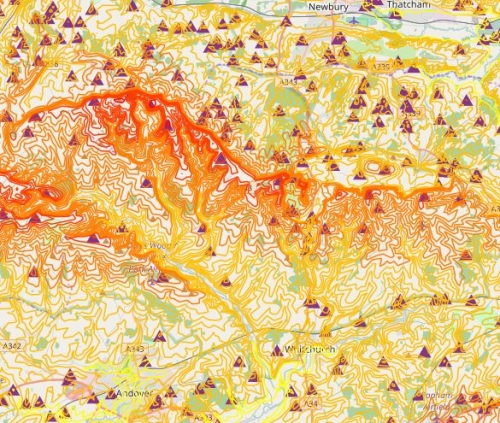
OS Terrain 50
Where to locate wind turbines and mobile phone towers with the help of OS Terrain 50.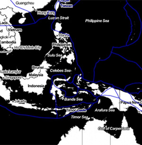
Location of Tectonic Plates
Identify the location and feature information of tectonic plates globally.