


News
Home | News | Using GIS To Plan Emergency Response Teams
Using GIS To Plan Emergency Response Teams

In recent years the use of Geographic Information System (GIS) to map crime within law enforcement and emergency service departments has become essential in order for them to become more transparent.
Historically, law enforcement agencies depended on the hardcopy maps to chart criminal activity. However, they were static and as crime rates increased, they became difficult to manage. Leading to discrepancies in data, due to information not being updated in real time. To resolve this, law enforcement agencies and other emergency teams have been encouraged to adopt digital mapping to manage and publish incidents in real-time.
To become more transparent, law enforcement agencies have turned to GIS to sort, organise, analyse and disseminate their data. Using GIS to map crime type, location, outcome and crime ID, agencies are removing the need to duplicate tasks whilst becoming more transparent in the sharing of information between other departments and external stakeholders.
Using GIS, law enforcement agencies can present data on a map using points, lines and polygons. In addition they can present data as a heat or thematic map to highlight crime hotspots to take the necessary remedial action. GIS enables law enforcement and emergency response units with the tools to capture, store, integrate and manipulate various layers of data, allowing users to analyse data in spatial environment.
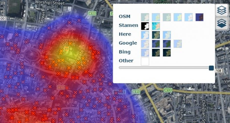
One of the key advantages of using GIS for law enforcement and emergency response departments is having the ability to display feature information on base layer use as OSM, Google, Bing, Here or other.
The real power of GIS is that is provides users with an opportunity to visualise and analyse multiple layers of information on a single map. Administrators can create additional layers, integrate disparate datasets from multiple sources such as planning, fire, ambulance and police departments as well as data from utility and the road network.
The key benefit of an integrated approach is that it creates a centralised repository for all spatial data, which can then be analysed to implement the necessary remedial action.
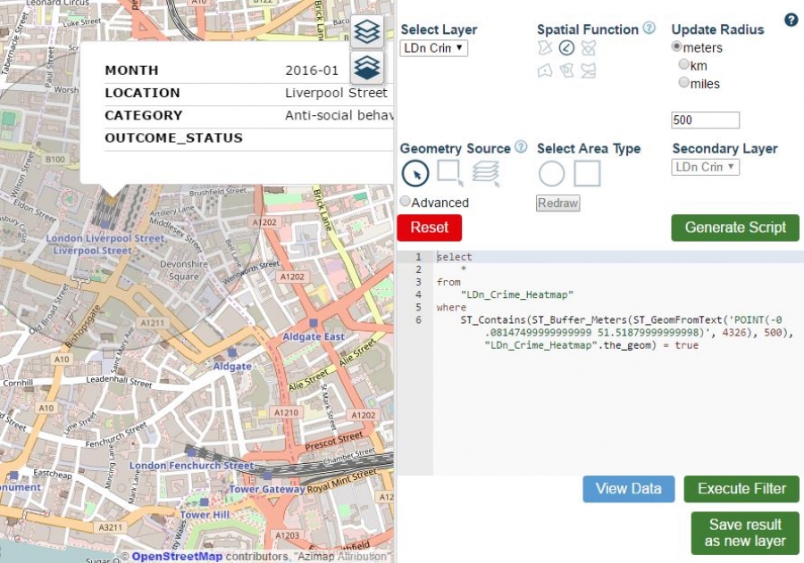
Another example of how GIS is helping law enforcement and other emergency response teams, is that it provides them with the tools to the carry out spatial searches.
Using the spatial search features (buffer, intersects, touches etc.) administrators can identify relationships in features or locations compared to another, for example identify all reported cases of violence or theft within 1,000 meters of a train station based on time of day. This information can then be used to increase police presence during times of day when crime might occur, ensuring that local communities feel safe and reduce crime rates.
In addition, due to the ability to share information in realtime, response units on the street can access GIS to make data-driven decisions. This is possible because GIS can track changes over time and can therefore be used to make informed strategic decisions to ensure the safety of local communities.
Ultimately, GIS technology empowers law enforcement and emergency response units to become efficient in the dissemination, management, visualisation and sharing of their spatial data, enabling them to become more accountable to the communities they serve. Explore our reference maps which showcases reported crimes in London and homicides in Mexico.
If your spatial data is in an Excel, CSV, spatial CSV, shape or KML file types sign up to a 30 free trials of Azimap Pro and visualise, analyse and share your spatial data on dynamic web maps.
Information source: Office of Justice Programs


