


gis News
Home | News

Celebrate GIS Day 2017
24th Oct 2017
GIS Day provides an international forum for users of geographic information systems (GIS) technology to demonstrate real-world applications that are making a difference in our society.
Wild Fire Investigation Open Source Data and Software
21st Aug 2017
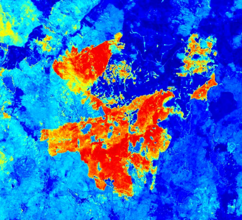
2017 has seen many wildfires rage across the Irish countryside, with a significant number of these receiving much media attention for the devastation they have caused to rural environments. A large number of these wildfires have occurred in upland areas in counties such as Wicklow, Galway, Kerry and Donegal.

Our Team Is Growing
24th Jul 2017
To support our commitment to create the most innovative and flexible cloud based GIS we are currently seeking to recruit a senior software developer and sales executive to join our team.

Azimap Remote Data Capture App Is Coming
20th Jul 2017
Today we’re delighted to announce the Azimap remote data capture app will be launching Autumn 2017.
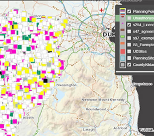
Kildare County Council Launch GIS Planning Portal
22nd Jun 2017
The planning enquiry portal provides citizens with an interactive map and search resource to view planning related information.


