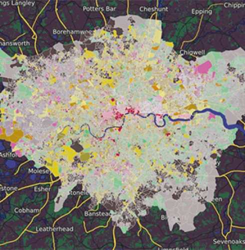
Oak & Park Royal Development Boundary
https://goo.gl/d17gYY
Web Map highlighting the development boundary in the Oak and Park Royal regeneration development project.
This data is beneficial for any business or first time buyer considering moving to Oak and Park area of London. Use the following spatial analysis tools to -
- Draw Radius - using the draw radius feature place the buffer in Kilometers or miles from your preferred location to identify local amenities such as public transport links, local parks, medial services and distance from major road network within your desired area
- Google Street View - use the Google Street View tool to view your preferred location at street level. By placing the marker on any road you can see your preferred area without having to visit an alternative application or physically visit the location. This feature helps during the research stage in the requirements stage by being more efficient saving time and money
This map has been created using open data from London.gov.uk and has been visualised on OSM standard map view.
Start visualising your location data today by subscribing to a free 30 day trial of Azimap Professional or alternatively request a personalised demonstration.