


News
Home | News
ReportAll Partners With Azimap To Publish and Share Incident Reports With Local Authorites
8th Mar 2017
ReportAll is a mobile app, which is available to download from both the iTunes and Android stores. ReportAll provides the public with the opportunity to report incidents of illegal tipping, graffiti, dog fouling and litter directly from their smartphone and to local authorities.
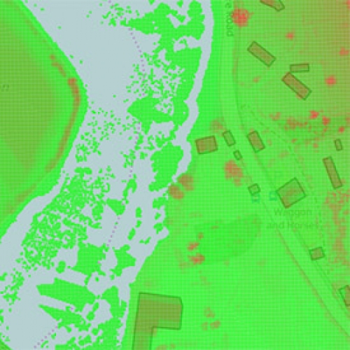
Raster Support And Enhanced GIS Functionality
27th Feb 2017
Azimap web GIS, which is currently used by hundreds of GI professionals worldwide, is delighted to announce with immediate affect the availability of raster support, point clustering, the ability to create a hierarchical structure of layers and numerous user interface enhancements.

Leading Regional Newspaper uses Azimap
23rd Jan 2017
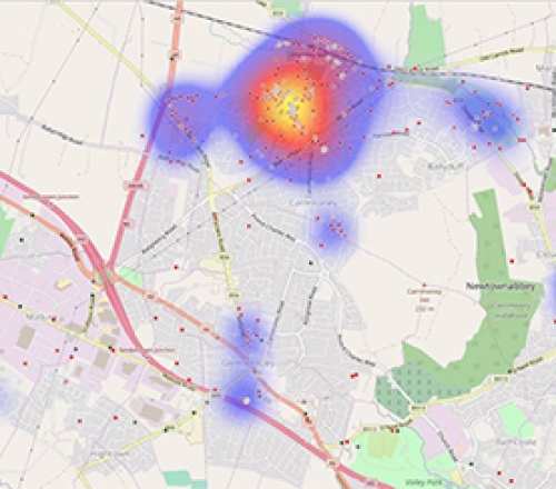
We’re delighted to announce that the Irish News, a leading regional newspaper used Azimap to publicise the location of RHI applications.
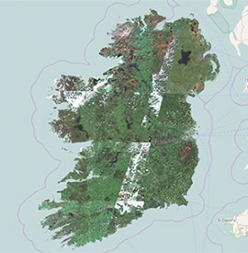
Sentinel-2a Map of Ireland
18th Jan 2017
Our key partner Mallon Technologywho has extensive experience in remote sensing shares Sentinel-2a map of Ireland. This map was created using imagery captured by the Copernicus programme.
Raster Support is Coming
6th Jan 2017
During 2016 we exhibited at numerous geospatial industry trade events. This provided the team with the opportunity to showcase Azimap to the industry. It was at these trade events, it was confirmed Azimap was missing one vital feature, Raster support.


