


News
Home | News | Sentinel-2a Map of Ireland
Sentinel-2a Map of Ireland

Following a year in which the European Space Agency's (ESA) Copernicus programme captured more of Earth than ever before, we are delighted to share with you the first complete map of Ireland using images captured by ESA's Sentinel-2a satellite.
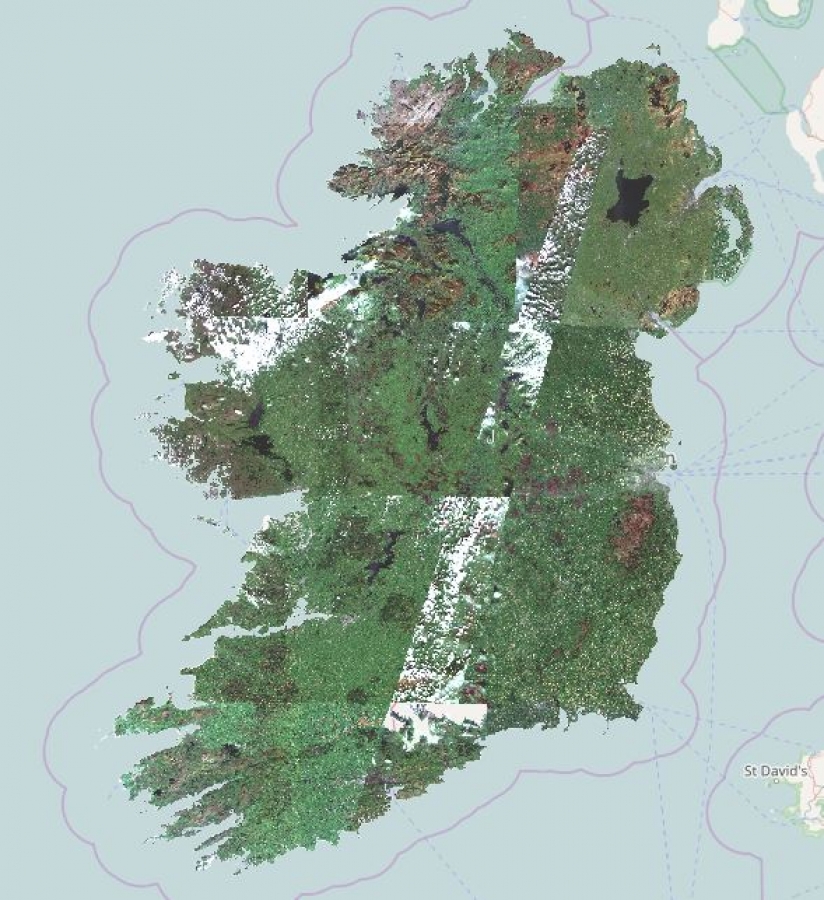
The Copernicus programme is at the cornerstone of the European Union's efforts to monitor the Earth and its diverse ecosystems. Copernicus consists of a series of earth observation satellites, which collect data across six thematic areas; land, marine, atmosphere, climate changes, emergency management & security, through various remote sensing technologies. The map was produced using a sequence of different images and represents the most up-to-date view of Ireland as captured from space.
This map which was created by our partner Mallon Technology, who has extensive experience in remote sensing. It is this experience that has enabled them to use the Copernicus programme to help clients in a wide range of different sectors for example flood analysis in Athlone, Co. Westmeath which used satellite imagery to assess the impact of floods to make informed decisions for future flood prevention measures.
To learn more about how data from the Copernicus programme or Sentinel satellites could benefit your organisation, contact Mallon Technology.


