We are delighted to announce that Azimap version 5.7 is now available for all existing customers and anyone who signs up to try Azimap Professional, which is free for 30 days.
The latest launch includes the usual bug fixes and minor enhancements to ensure that Azimap runs smoothly for all our customers. We have also ensured that all accounts are now in line with the new GDPR legislation.
Additionally, version 5.7 introduces several significant new features, reaffirming our commitment to providing the most feature-rich and powerful web GIS available. New features released in Azimap 5.7 include:
Sketch Layer Tool
Our all-new sketch layer tool enables users to draw temporary features (points, lines or polygons) onto maps. Once drawn, text annotations can be added to provide further descriptions of each individual feature. These can then be saved locally or shared with other users via a web link.
The Sketch Layer tool will help organisations and individuals significantly improve project collaboration. With sketch layers, teams in one department or location can create and share project updates on a map, which can then be confirmed by a team in another location or department. Confirmed changes will then be instantly updated to ensure all colleagues are working with the same data and information.
The sketch tool will significantly enhance collaboration in organisations that undertake projects off-site, enabling visual updates to be provided to colleagues back in the office.
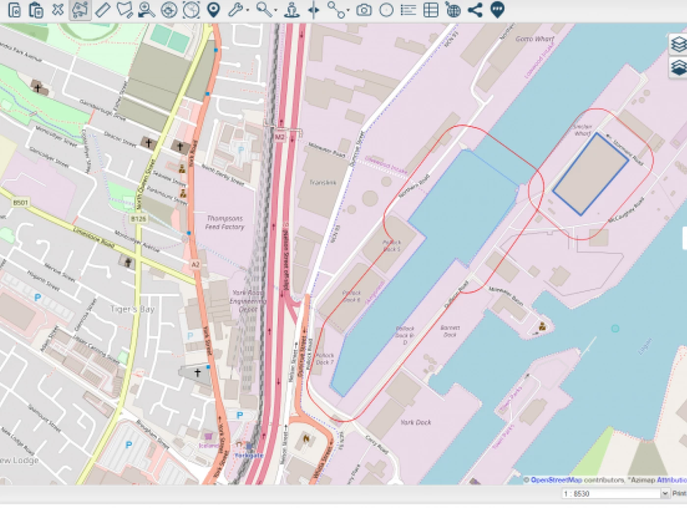
Speed Limit Tool
Newly added alongside our existing routing and drive time analysis tools, the speed limit tool enables users to check the speed limit of any road of interest to them at the click of a button. Using the tool, select the road of interest to bring up the maximum speed limit, the type of road, and its name.
The new tool will help organisations improve their planning of external works, ensuring the safety of staff while operating off-site. By identifying the speed limits of roads where work is to take place, organisers will be able to advise staff on the appropriate safety measures to take, the equipment needed, and whether temporary traffic calming measures should be implemented to further protect colleagues.
Speed limit information is derived from OpenStreetMap, and no warranty is given on the accuracy of the information.
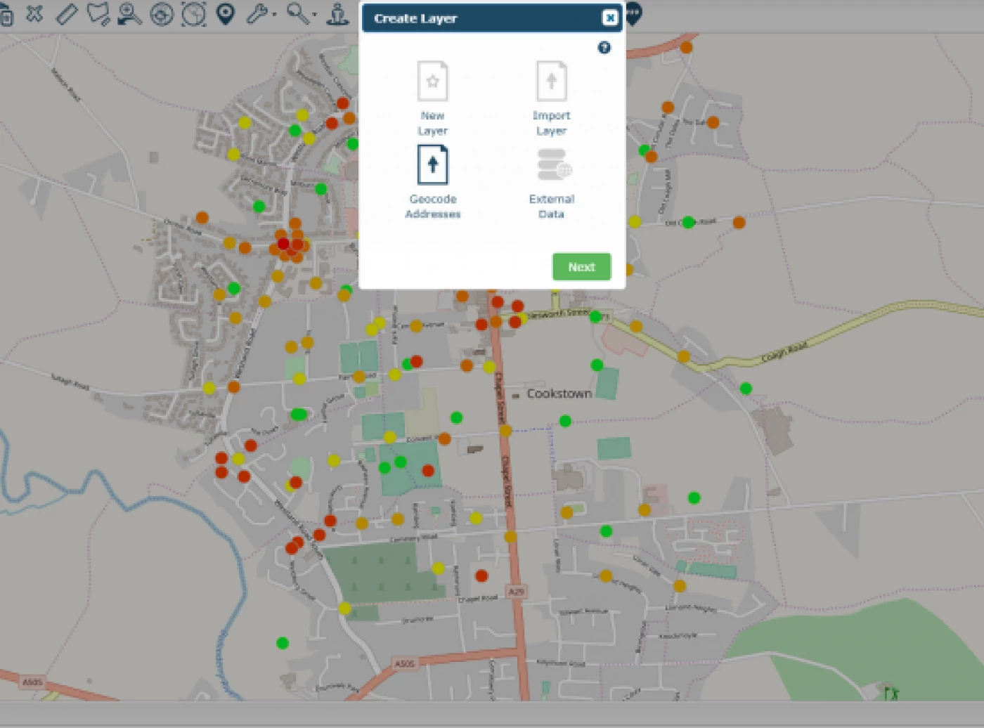
Data Joins
The new data joins tool enables users to join disparate datasets and link information without the need for third-party tools or software. Users can easily join the information contained within two datasets by linking their corresponding columns. The data joins tool will help to save users valuable time and effort, along with any associated costs from using third-party tools, enabling them to focus on gaining valuable insights from their data.
The new tool will now enable organisations to merge data held in spreadsheets with location information. Previously, this data would have been hard to visualise or gain insights from, but with the data joins tool, such information can be given a new perspective. Meaningful insights can then be derived from further analysis, which can be used to inform strategic business decisions.
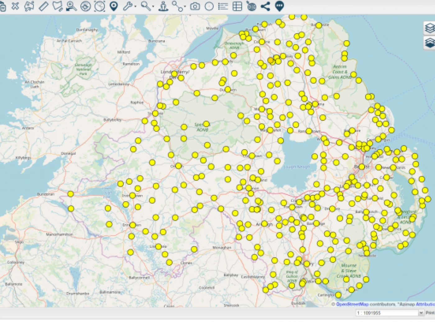
Geocoding
The geocoding of address information is now possible in Azimap! Available under data imports, Azimap can now automatically match your address information to a location on the map. Correctly formatted CSV files can be dragged into the data importer, and Azimap will handle the rest for you; all that is required is an address column.
Azimap geocoding will help organisations save valuable time by eliminating the need for manual digitisation of address data. Handling large numbers of addresses, the automatic geocoding of addresses reduces map creation time, enabling organisations to focus on gaining new insights from their data.
Please note that data limits apply to the number of addresses that can be geocoded in any month. Users who sign up for a 30-day free trial of Azimap Professional can import up to 100 addresses to be geocoded; however, different limits apply to our paid plans. Your remaining data limits can be seen in the admin section of your account.
Learn More
The second release of 2018 continues to confirm our commitment to providing a dynamic, feature-rich, and scalable web GIS for our customers. All the latest features and improvements of Azimap version 5.7 can be experienced for yourself by signing up for a free 30-day trial, or learn more by arranging a personalised demonstration to see how Azimap could benefit your organisation.