Visualise your Geo Spatial Data with AziMap
Use Azimap's data visualisation tools to import and digitise your location data on dynamic web maps

GIS for Location Intelligence
Learn how to improve cross functional collaboration, transparency and workflow management with GIS.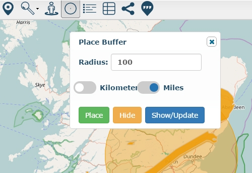
How to place a radius around a point
Using the place radius tool editors can place a radius around a point.
GIS For Business
Suitable for organisations who would like to learn how to use GIS to analyse consumer behaviour.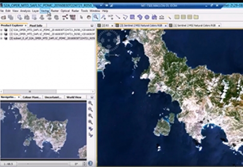
Getting Started with Sentinel-2
Learn how government departments make decisions, based on the analysis of Sentinel-2 imagery.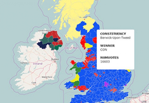
Create A Predominance Map
In this guide you will learn how to quickly create a predominance map.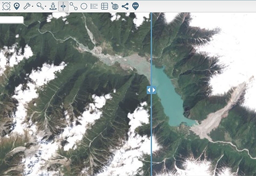

Layer Swipe Map of Zhamu Creek Landslide
One of the world's largest recorded landslides occurred at Zhamu Creek in Eastern Tibet.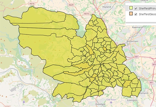
Sheffield Primary and Secondary School Catchment Areas
Primary and secondary school catchment areas within Sheffield City Council
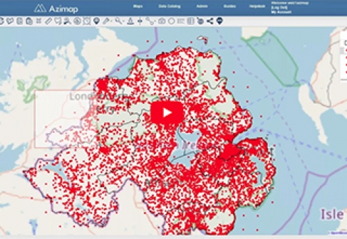
Mid Ulster Council Digitises Waste Collection Data
Mid Ulster Council digitises the collection of trade waste and increases productivity by 80%.
EU Member State Geo-Spatial Data Quality Project
Mallon Technology partners with Azimap, to ensure the EU scheme was implemented correctly.